


Winter Operations
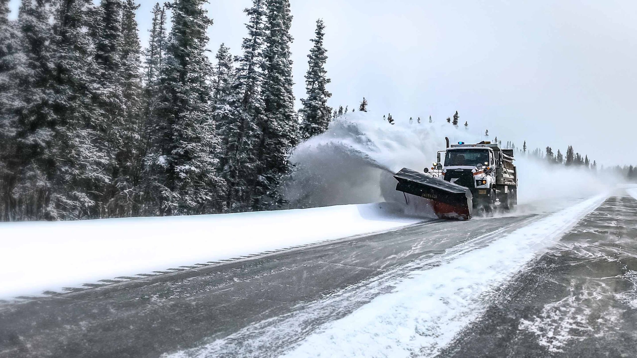
Winter operations depend on timing, visibility, and accountability. GPS Tracking Canada provides Geotab-integrated solutions that help municipalities, contractors, public works departments, and winter maintenance fleets monitor snow plows, salt trucks, sanders, service vehicles, and support equipment from one connected platform. With real-time vehicle tracking, route history, salt usage visibility, equipment activity reporting, and maintenance insights, winter fleet managers can respond faster, control costs, and provide stronger proof of service during every storm event.
Improve Snow Plow Visibility in Real Time
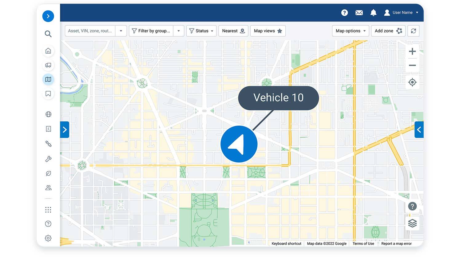
During winter weather, fleet managers need to know where every plow, salter, and support vehicle is. A Geotab-integrated GPS tracking system helps teams view vehicle location, route progress, stop activity, and service coverage in real time. This makes it easier to dispatch the closest available unit, monitor priority routes, and confirm that roads, parking lots, yards, or municipal service areas are being cleared as planned.
Track Salt, Sand, and Material Usage
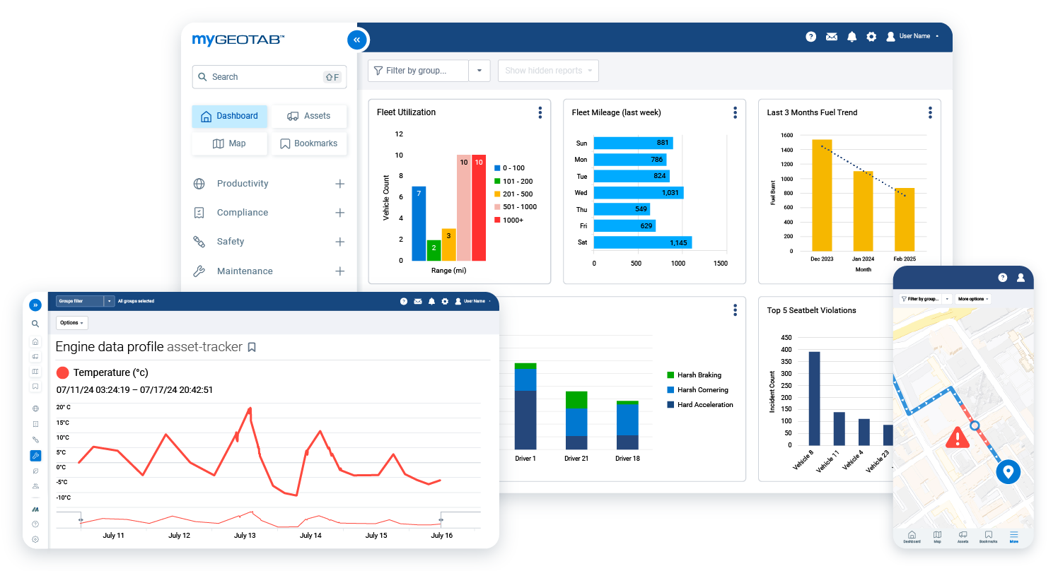
Salt and sand are major winter operating costs, and over-application can create unnecessary expense and environmental impact. Geotab winter operations solutions can help monitor material application activity, giving managers better insight into how much salt or de-icing material is being used, where it is being applied, and how operations compare across routes, drivers, and weather events. This supports smarter material planning, better reporting, and more responsible salt management.
Provide Proof of Service for Municipal and Contract Work
Winter operations often require clear documentation for service verification, billing, complaint response, and liability protection. GPS Tracking Canada helps fleets use Geotab data to create time-stamped records of vehicle location, route completion, plow activity, salting activity, and trip history. This gives managers a reliable digital record when they need to confirm when a road, property, or service area was maintained.


Optimize Routes and Reduce Unnecessary Mileage
Efficient routing matters when crews are working under pressure. Geotab routing and dispatching tools can help winter operations teams reduce route overlap, adjust plans as conditions change, and use vehicle location data to make faster dispatch decisions. Better route visibility can reduce unnecessary mileage, fuel use, driver confusion, and delays during snow removal or de-icing operations.
Control Fuel, Idling, and Operating Costs
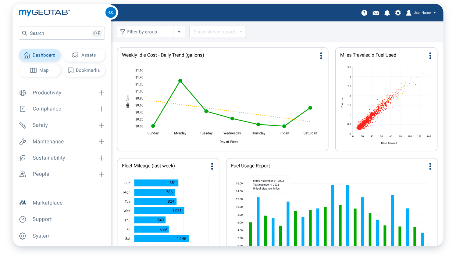
Winter fleets often face high fuel use due to long shifts, heavy equipment, cold starts, and extended idling. With Geotab reporting, managers can review fuel trends, idling activity, vehicle utilization, and driver behaviour across the fleet. These insights help identify avoidable costs, coach better habits, and improve the efficiency of winter maintenance operations without reducing service quality.
Support Preventive Maintenance and Fleet Readiness
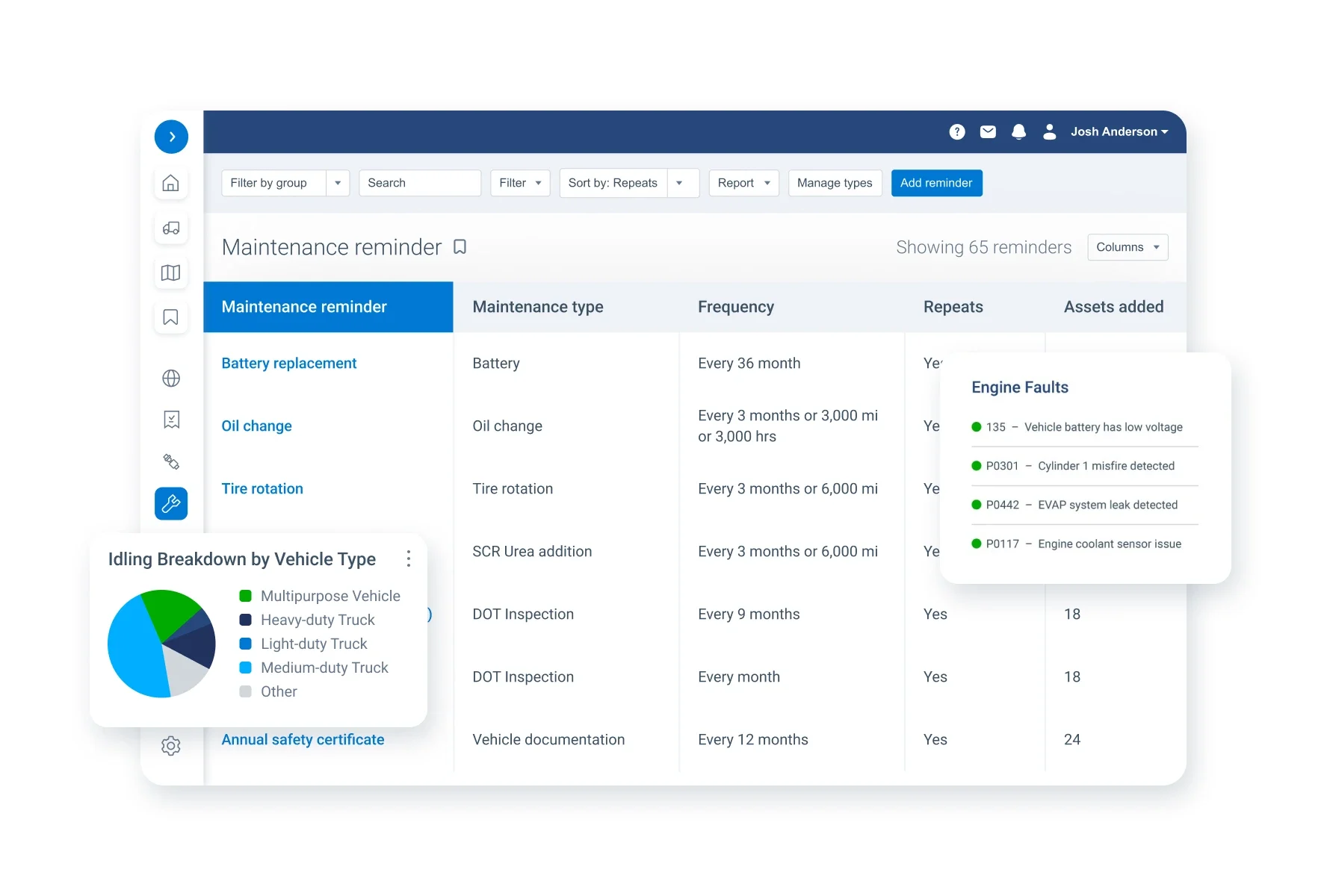
Winter equipment needs to be ready before the storm begins. Geotab vehicle diagnostics and maintenance tools can help managers monitor engine data, fault codes, mileage, engine hours, and service needs. This allows winter operations teams to schedule maintenance more proactively, reduce unexpected downtime, and keep plows, spreaders, and support vehicles available when they are needed most.

Frequently asked questions
What is GPS tracking for winter operations?
GPS tracking for winter operations uses connected vehicle devices and fleet management software to monitor snow plows, salt trucks, sanders, support vehicles, and winter maintenance equipment in real time.
How can GPS Tracking Canada help winter operations fleets?
GPS Tracking Canada provides Geotab-integrated solutions that help winter fleets track vehicle location, route progress, salt usage, equipment activity, maintenance needs, and service history from one platform.
Why do winter operations fleets need GPS tracking?
Winter fleets need GPS tracking to improve visibility, respond faster during storms, confirm completed routes, manage material usage, reduce downtime, and provide proof of service.
Can Geotab be used for snow plow tracking?
Yes. Geotab can help track snow plows in real time, monitor route completion, review trip history, and support reporting for snow removal operations.
Can GPS tracking show where salt trucks have been?
Yes. GPS tracking can show vehicle routes, stops, activity history, and service coverage so managers can verify where salt trucks have travelled during winter operations.
Can Geotab help monitor salt and sand usage?
Yes. With the right setup and integrations, Geotab can help winter operations fleets monitor material usage, including salt, sand, and de-icing activity.
How does GPS tracking improve snow removal response time?
GPS tracking helps dispatchers see where vehicles are, identify the closest available unit, adjust routes, and respond more quickly to changing road or weather conditions.
What types of winter operations vehicles can be tracked?
GPS tracking can support snow plows, salt trucks, sanders, sidewalk plows, loaders, patrol vehicles, service trucks, and other winter maintenance vehicles.
Can GPS tracking help provide proof of service?
Yes. GPS tracking creates digital records of vehicle location, route history, time on site, and activity, helping fleets confirm when and where winter maintenance work was completed.
How does Geotab support public works winter operations?
Geotab supports public works fleets with vehicle tracking, route visibility, material usage insights, maintenance tools, reporting, and fleet activity monitoring.
Can GPS tracking help reduce winter fleet costs?
Yes. GPS tracking can help reduce costs by identifying unnecessary idling, route overlap, inefficient vehicle use, excessive fuel consumption, and preventable maintenance issues.
How does GPS tracking help with winter fleet maintenance?
Geotab can monitor vehicle diagnostics, engine data, fault codes, mileage, and engine hours, helping managers schedule maintenance before equipment failure causes downtime.
Can winter operations managers see completed plow routes?
Yes. Route history and trip reporting can help managers review which roads, lots, or service areas were covered by each vehicle.
Can GPS tracking help answer resident or customer complaints?
Yes. GPS tracking records can help confirm whether a road, property, or route was serviced, making it easier to respond to complaints with accurate information.
Does Geotab support real-time winter fleet alerts?
Yes. Geotab can support alerts for events such as vehicle movement, idling, route activity, safety events, maintenance issues, and other fleet conditions.
Can GPS tracking help reduce salt waste?
Yes. By improving visibility into salt application activity and service patterns, GPS tracking can help fleets identify overuse, improve planning, and manage materials more responsibly.
Is GPS tracking useful for private snow removal contractors?
Yes. Private contractors can use GPS tracking to verify completed work, improve dispatching, manage crews, support billing, and provide service records to customers.
Is GPS tracking useful for municipalities?
Yes. Municipalities can use GPS tracking to monitor public works vehicles, improve winter road maintenance, support accountability, manage materials, and provide better service visibility.
What Geotab products are useful for winter operations?
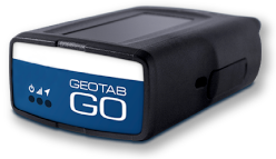
Useful Geotab solutions can include the Geotab GO device, MyGeotab fleet management software, Geotab Public Works tools, routing and dispatching features, fleet reports, maintenance tools, and compatible Marketplace integrations.
How can I get started with winter operations GPS tracking?
Contact GPS Tracking Canada to discuss your winter fleet, vehicles, routes, reporting needs, and Geotab solution options.

Check Pricing
All of our GPS tracking solutions are customized for your business and tailored to your budget...

Return on Investment
At GPS Tracking Canada, we understand that every company benefits from GPS Tracking in different ways...

Request a Demo
Get a live one-on-one demonstration from GPS Tracking Canada. See for yourself how customized...
For more information, or to schedule a demo or an installation,
call us toll free at 1.877.477.0987